


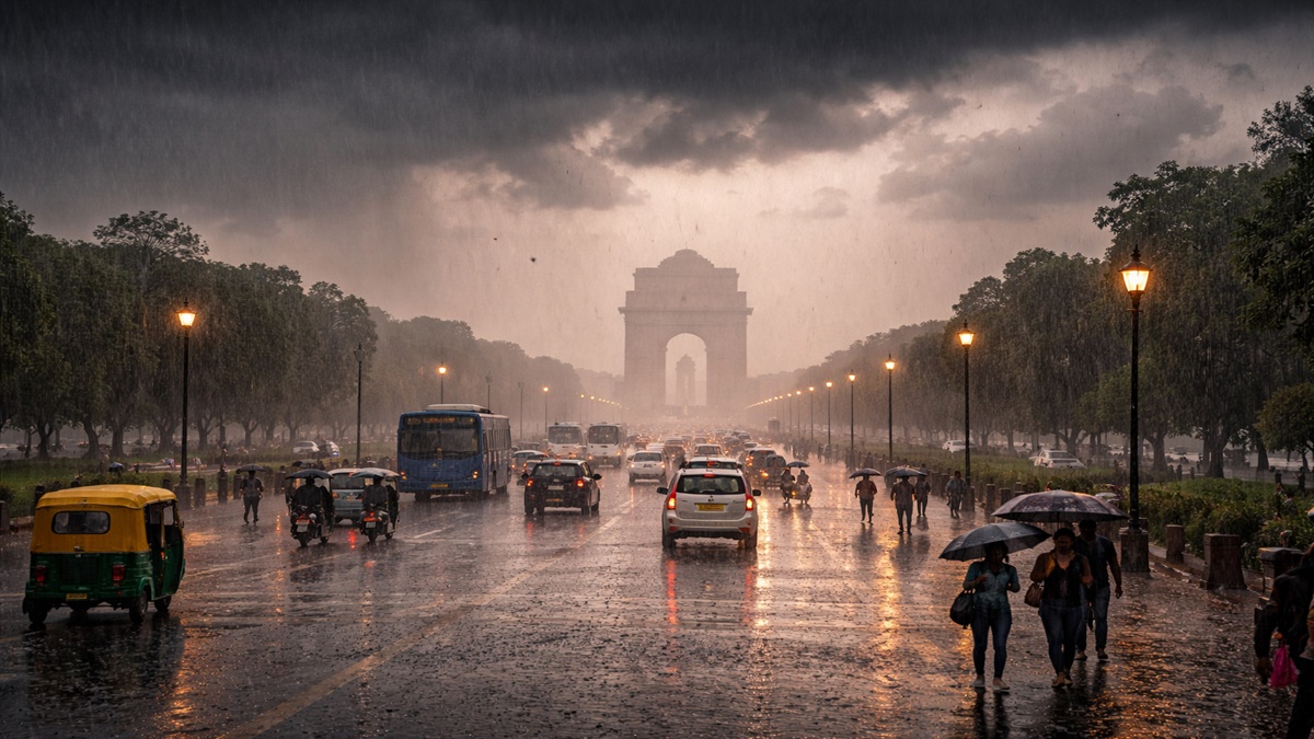
After nearly a week of intense heat, with temperatures hovering close to 44°C, residents of the national capital finally got some relief on Wednesday morning as rain lashed several parts of the city.
Showers began early in the day, with low-hanging clouds blanketing the skies across Delhi. The rainfall brought down temperatures and eased the persistent humidity.
A sudden shift in weather patterns led to dark clouds, strong winds, and refreshing showers across various parts of the city, including Kushak Road and the Lutyens’ Delhi area.
The capital had been under a “yellow alert” for heatwave conditions, with temperatures ranging between 42°C and 45°C over the past few days. However, as predicted by the India Meteorological Department (IMD), a western disturbance triggered atmospheric activity, causing a sharp drop in temperature within a short span.
The maximum temperature, earlier expected to touch 41°C, is now likely to settle around 38°C following the rain.
According to the Regional Weather Forecast Centre (RWFC) in New Delhi, light to moderate rainfall accompanied by thunderstorms, lightning, and gusty winds of 30–40 kmph was very likely across Delhi and adjoining areas during the morning hours.
“Light to moderate rainfall accompanied by thunderstorms, lightning, and gusty winds (30–40 kmph) is very likely over Delhi and NCR, as well as in parts of Haryana, Uttar Pradesh, and Rajasthan,” RWFC said in a statement.
Further, RWFC indicated that light rainfall is also likely in several areas of Haryana, including Panipat, Hisar, Jind, Bhiwani, and nearby regions, as well as in parts of western Uttar Pradesh.
Strong winds and intermittent showers brought a noticeable change in Delhi’s weather, with several areas reporting cloudy skies and wet roads following the rainfall.
Meanwhile, data from the Central Pollution Control Board (CPCB) showed that Delhi’s air quality stood at an AQI of 260, placing it in the “poor” category.
On Tuesday, IMD scientist Akhil Srivastava spoke about weather alerts issued for northern, eastern, and western regions of the country.
He said thunderstorm activity is expected in Punjab and Haryana over the coming days, which may bring down temperatures by 2–4°C.
Srivastava added that an orange alert has been issued for thunderstorms in Bihar, Gangetic West Bengal, Odisha, and Jharkhand, while northeastern states are likely to receive heavy to very heavy rainfall over the next week.
“In the northern region, heatwave conditions have persisted for the past 15 days. However, due to a western disturbance centred around 66°E longitude, thunderstorm activity is expected over the Western Himalayas and adjoining plains. Alerts have been issued for Jammu and Kashmir, Himachal Pradesh, and Uttarakhand for thunderstorms and hailstorms. Punjab and Haryana may witness thunderstorms with wind speeds of up to 60 kmph, leading to a drop in maximum temperatures by 2–4°C over the next three days,” he said.
On the outlook ahead, he noted that heatwave conditions are likely to continue in parts of Rajasthan, Madhya Pradesh, Vidarbha, and Marathwada for now, but are expected to ease gradually. Eastern India remains under an orange alert for severe thunderstorms, while northeastern states are forecast to receive heavy to extremely heavy rainfall, with red alerts issued in several areas.
-ANI


