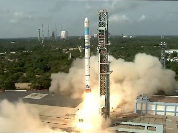
The Indian Space Research Organisation (ISRO) successfully launched the Earth Observation Satellite-8 (EOS-8) on Friday from the Satish Dhawan Space Centre in Sriharikota, Andhra Pradesh. The launch was carried out using the Small Satellite Launch Vehicle (SSLV) in its third and final developmental flight.
In a post on X, ISRO said, “The third developmental flight of SSLV was successful. The SSLV-D3 placed EOS-08 precisely into the orbit. This marks the successful completion of ISRO/DOS’s SSLV Development Project. With technology transfer, the Indian industry and NSIL India will now produce SSLV for commercial missions.”
The six-and-a-half-hour countdown for the launch began at 2:47 AM.
The primary objectives of the EOS-08 mission, designed for a one-year duration, include developing a microsatellite, creating payload instruments compatible with the microsatellite bus, and incorporating new technologies required for future operational satellites, an ISRO release said earlier.
The satellite is built on the Microsat/IMS-1 bus and carries three key payloads: the Electro-Optical Infrared Payload (EOIR), the Global Navigation Satellite System-Reflectometry Payload (GNSS-R), and the SiC UV Dosimeter.
The EOIR payload is designed to capture images in the Mid-Wave IR (MIR) and Long-Wave IR (LWIR) bands, both during the day and night, for applications such as satellite-based surveillance, disaster monitoring, environmental monitoring, fire detection, volcanic activity observation, and industrial and power plant disaster monitoring. The GNSS-R payload demonstrates the capability of using GNSS-R-based remote sensing for applications such as ocean surface wind analysis, soil moisture assessment, cryosphere studies over the Himalayan region, flood detection, and inland waterbody detection.
EOS-08 marks a significant advancement in satellite mainframe systems such as an Integrated Avionics system, known as the Communication, Baseband, Storage, and Positioning (CBSP) Package, which combines multiple functions into a single, efficient unit. This system is designed with cold redundant systems using commercial off-the-shelf (COTS) components and evaluation boards, supporting up to 400 GB of data storage. Additionally, the satellite includes a structural panel embedded with PCB, an embedded battery, a Micro-DGA (Dual Gimbal Antenna), an M-PAA (Phased Array Antenna), and a flexible solar panel, each serving as key components for onboard technology demonstration.
(ANI)


