


In a groundbreaking discovery, researchers from the Indian Institute of Geomagnetism (IIG) have identified seismogenic liquefaction features in the active Kopili Fault (KF) zone, providing crucial insights into the region's seismic history and offering significant advancements in earthquake preparedness.
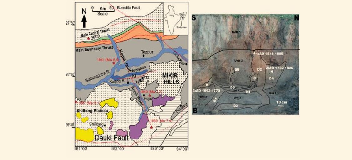
The Kopili Fault, a 300 km long and 50 km wide lineament situated in the northeastern region (NER), extends from the western part of Manipur to the tri-junction of Bhutan, Arunachal Pradesh, and Assam. With a documented history of significant earthquakes in 1869 and 1943, the recent study, focusing on paleoseismic investigations, emphasizes the importance of comprehending past seismic activity to enhance preparedness for future earthquakes.
Paleoseismic investigations, commonly conducted through trenching studies, involve digging a trench, and a geologist logs the geological attributes of the rock layers.
Seismogenic liquefaction features, including multiple sand dykes and sand sills, were pinpointed in the Kopili Fault zone. Liquefaction, the transformation of granular material from a solid to a liquefied state due to increased pore water pressure, serves as crucial secondary evidence of earthquakes. This phenomenon occurs primarily in soft sedimentary sequences, making it essential for designing infrastructure like bridges and large buildings to withstand potential seismic events.
To mitigate future earthquake occurrences in the Kopili Fault zone, scientists conducted investigations at three trench sites in the floodplain deposits of the Kolong River, near KF. The identified liquefaction features, including sand dykes and sand sills, directly respond to the liquefaction of saturated sediment induced during past seismic activity.
The study utilized a technique called optically stimulated luminescence (OSL) dating on seven samples from marker horizons to constrain the chronology of liquefaction features. The OSL age constraints revealed evidence of two earthquake-induced liquefaction events near the Kopili Fault approximately 480 years ago.
This crucial information aids in the interpretation of the long-term rupture history of faults and intraplate seismicity in the region. The findings, published in Natural Hazards, highlight the significance of paleoseismic investigations in providing valuable insights into past earthquakes, even in the absence of surface rupture.
Understanding the recurrence period of major earthquakes in the Kopili Fault zone becomes imperative for devising effective strategies to mitigate seismic risks and enhance the resilience of infrastructure in the region. The study's outcomes underscore the role of geological and geomorphological investigations in shaping preparedness for potential seismic events, ultimately contributing to the safety and resilience of communities in earthquake-prone areas.


