Hurricane Milton became the third-fastest intensifying Atlantic storm on record as it headed towards Florida’s west coast, threatening to swamp low-lying areas with a life-threatening storm surge, according to the U.S. National Hurricane Center.
WHEN WILL HURRICANE MILTON HIT FLORIDA?
Milton’s center has been moving northeast across the Gulf of Mexico at about 16 mph (26 kph). Forecasters expect it to make landfall around Florida’s Tampa Bay area late on Wednesday night or early Thursday morning, according to the hurricane center.
HOW BIG IS MILTON?
As of Wednesday morning, Milton had maximum sustained winds of about 155 mph (249 kph), according to the hurricane center. Hurricane-force winds extend outward up to 30 miles (45 km) from its center, and tropical-storm-force winds extend outward up to 125 miles (205 km).
WHY IS HURRICANE MILTON SO FEROCIOUS?
The unusually warm waters in the Gulf of Mexico this year have fueled Milton’s rapid growth. Surface waters have reached record-high temperatures of around 90 degrees Fahrenheit (32 degrees Celsius) during the past two summers, according to the U.S. National Oceanic and Atmospheric Administration.
WHERE ARE THE HURRICANE MILTON EVACUATION ZONES?
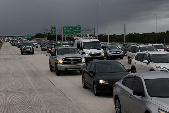
Fifteen of Florida’s 67 counties have issued mandatory evacuation orders for at least some residents, stretching along much of the west coast from Collier County to Levy County.
That includes many of the 3.1 million people who live in the Tampa metropolitan area, a dense cluster of low-lying communities along the coast and on the shelter islands of Tampa Bay, which has not been in a hurricane’s path in more than a century.
WHAT WARNINGS ARE FLORIDA RESIDENTS GETTING?
Although Floridians are accustomed to hurricanes, many state and local officials are warning residents that Milton may be the worst they have seen. Tampa Mayor Jane Castor has bluntly said that anyone who does not evacuate low-lying zones will die.
The hurricane center has forecast life-threatening storm surges of between 10 and 15 feet along Florida’s western coast from Anna Maria Island – on the south end of the entrance of Tampa Bay – to Boca Grande, about 70 miles (113 km) further south. It also forecast destructive hurricane-strength winds and torrential rainfall that could trigger flash flooding in much of central Florida.
HOW DOES HURRICANE MILTON COMPARE TO HURRICANE HELENE?
Many of the communities facing Milton are still recovering from Hurricane Helene last month, which killed more than 200 people after causing disastrous inland flooding, particularly in the mountains of western North Carolina and eastern Tennessee.
At its most intense, Helene was a Category 4 hurricane, reaching sustained winds of 140 mph (220 kph) and a minimum central pressure of 938 millibars at its peak. Milton quickly surpassed that, becoming a Category 5 storm within hours with sustained winds of 180 mph (285 kph) and a minimum central pressure of 897 millibars on Tuesday. Milton was downgraded slightly on Wednesday to Category 4.
WHAT ARE THE FIVE MOST INTENSE ATLANTIC HURRICANES?
The lower a hurricane’s minimum central pressure, the more intense it is. Milton has already become the fifth-most intense hurricane recorded in the Atlantic. The most intense hurricane on record is Wilma in 2005, with a minimum central pressure of 882 millibars, followed by Gilbert in 1988, the Labor Day hurricane of 1935, and Rita in 2005.
(Reuters)


